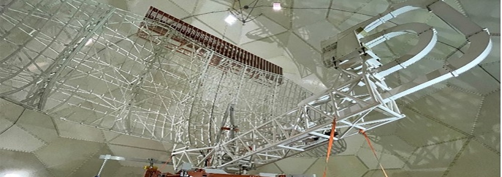
RISE® Radar Indoor System Elevator

RISE®
Radar Indoor System Elevator
The Techno Sky solution for reducing operational downtime of Long Range RADARs when replacing the antenna base bearing.
Operational Scenario:
RADARs are used for traffic control and require maintenance of electronic and mechanical components. A particularly critical operation is the replacement of the bearing located in the base of the antenna in the presence of a radome. Normally the bearing replacement operation requires the removal of the upper panels of the radome and the antenna by means of a mobile crane with an extendable arm. The RISE ® tool, entirely designed by Techno Sky, allows you to operate in total safety inside the radome without the need to remove the radome panels and without the use of external lifting systems.
Main technical features:
The tool is ready to use for long range RADAR model G-14 antennas, however adaptable to other antenna models. It consists of a kit of mechanical parts which, once disassembled, are stored inside crates whose dimensions allow the use of
conventional means of transport.
• Capacity: 5.800 Kg;
• Overall dimension: 5 m x 5,5 m.
Benefits:
The RISE® tool allows you to:
• increase the operational availability of the RADAR thanks to the drastic reduction of maintenance downtime compared to the use of conventional techniques;
• eliminate particularly dangerous processing phases;
• reduce the start-up times of activities even in the event of an emergency without the need for exceptional transport.
Certifications:
The tool is CE marked and complies with the directive of the European Parliament and of the Council 2006/42/EC of 17 May 2006
For further information about this product
Fill in the following form
